

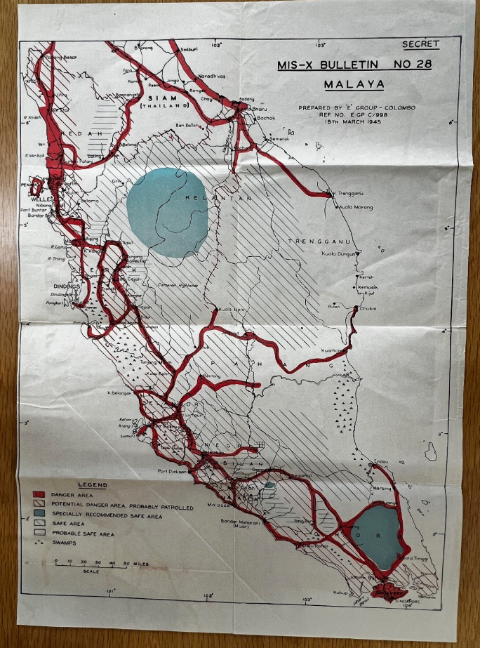
Image of Malaya map
The National Archives, London, UK. Used with permission.
Photo of map showing the varying “levels” of Japanese occupation depending on the region. The map shows two small inland areas in the north and south, marked in green, that are indicated as specially recommended safe areas, while the network of rivers and coastline on the south, west and north are marked in red as danger areas. Photo taken from original records held at the National Archives in London, England.